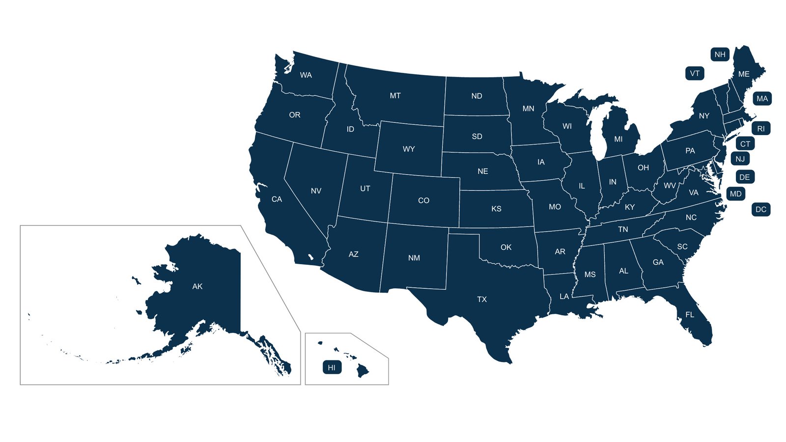
United States Map: A Complete Guide to the Country’s Geography, States, and Regions
A United States map is more than a simple picture showing state boundaries. It is a useful way to understand the geography, regions, cities, landscapes, transportation routes, and political divisions of one of the world’s largest countries. From the Atlantic Ocean to the Pacific Ocean, the United States covers a vast area with remarkable differences in climate, terrain, culture, and population.
Whether you are a student learning geography, a traveler planning a road trip, a teacher preparing a lesson, or simply someone interested in American geography, understanding how to read a United States map can make the country much easier to explore.
What Is a United States Map?
A United States map is a visual representation of the country and its geographic divisions. A basic map usually shows the 50 states, their borders, major cities, and surrounding bodies of water. More detailed maps can include highways, rivers, mountains, national parks, airports, counties, and other geographic features.
The United States is made up of 50 states and the District of Columbia. The country also has several territories and island possessions. On most maps, Alaska and Hawaii are displayed separately from the continental states because of their geographic locations.
Maps can be designed for different purposes. A political map focuses on state and national boundaries, while a physical map highlights mountains, rivers, deserts, plains, and other natural features. Road maps emphasize highways and transportation routes, while population maps can show where people are concentrated.
Understanding the 50 States
One of the most important features of a United States map is the division of the country into 50 states. Each state has its own government, capital city, laws, and geographic characteristics.
The states vary greatly in size. Alaska is the largest state by land area, while Rhode Island is the smallest. California and Texas are among the largest states in the contiguous United States. Despite their differences in size, every state plays a distinct role in the country’s geography and economy.
Looking at the states on a map also helps explain their locations. For example, Washington is located in the far northwest, Maine occupies the northeastern corner, Florida extends into the southeastern part of the country, and California borders the Pacific Ocean in the west.
The Contiguous United States
When people look at a standard United States map, they often focus on the contiguous United States. This area includes the 48 states that share continuous land borders.
The contiguous states stretch from Maine in the northeast to Washington in the northwest and from Florida in the southeast to California in the southwest. The region contains an enormous variety of landscapes.
The eastern part of the country includes the Appalachian Mountains, coastal plains, forests, and large metropolitan areas. Moving westward, the landscape changes into the Mississippi River Valley, Great Plains, Rocky Mountains, deserts, plateaus, and eventually the Pacific Coast.
This geographic variety is one reason maps are so useful for understanding the United States.
Alaska and Hawaii on the Map
Alaska and Hawaii require special attention when studying a United States map.
Alaska is located in the far northwestern part of North America. It is separated from the contiguous United States by Canada. The state is famous for its enormous wilderness areas, mountains, glaciers, rivers, and Arctic landscapes.
Hawaii is located in the Pacific Ocean, far southwest of the continental United States. It is an island state made up of several major islands and smaller islands. Its tropical climate and volcanic landscapes make it geographically different from every other U.S. state.
Because placing Alaska and Hawaii in their actual locations would make a standard U.S. map difficult to read, many maps display them in small inset boxes near the lower-left corner.
Major Regions of the United States
A map becomes easier to understand when the country is divided into broad geographic regions. There are several ways to classify these regions, but common divisions include the Northeast, Midwest, South, and West.
The Northeast
The Northeast contains states such as New York, Pennsylvania, New Jersey, Massachusetts, Connecticut, Vermont, New Hampshire, Maine, and Rhode Island.
This region includes some of the country’s oldest European settlements and major cities. New York City, Boston, Philadelphia, and other metropolitan areas are important economic and cultural centers.
The Northeast also includes the Appalachian Mountains and a long Atlantic coastline. On a map, it appears relatively compact compared with the enormous western states.
The Midwest
The Midwest generally includes states such as Illinois, Indiana, Michigan, Ohio, Wisconsin, Iowa, Minnesota, Kansas, Nebraska, Missouri, North Dakota, and South Dakota.
This region is known for agriculture, manufacturing, large freshwater resources, and extensive plains. Chicago is one of its most important cities.
The Great Lakes are particularly significant on a United States map. They form a major freshwater system along parts of the northern United States and help define the geography of several states.
The South
The South covers a large area and includes states such as Texas, Florida, Georgia, Alabama, Mississippi, Louisiana, Tennessee, Kentucky, North Carolina, South Carolina, Virginia, and West Virginia, among others depending on the regional classification used.
The region contains beaches, forests, mountains, wetlands, agricultural areas, and major cities. Texas and Florida are especially prominent because of their large populations and geographic size.
The Gulf of Mexico borders several southern states, while the Atlantic Ocean forms much of the eastern coastline.
The West
The western United States contains some of the country’s largest and most geographically diverse states. California, Oregon, Washington, Nevada, Arizona, Utah, Idaho, Montana, Wyoming, Colorado, New Mexico, and Alaska are commonly associated with the West.
The region includes the Rocky Mountains, Sierra Nevada, Cascade Range, Great Basin, Mojave Desert, Colorado Plateau, and Pacific Coast.
Maps of the West often reveal how dramatically elevation and climate can change over relatively short distances.
Major Physical Features on a United States Map
A physical United States map provides an excellent overview of the country’s natural geography.
The Rocky Mountains extend through a large portion of the western United States. They influence climate, rivers, transportation, agriculture, and settlement patterns.
The Appalachian Mountains run through parts of the eastern United States. Although they are much older and generally lower than the Rocky Mountains, they remain an important geographic feature.
The Great Plains occupy a broad area east of the Rocky Mountains. This region is particularly important for agriculture and contains extensive grasslands.
The Mississippi River is another major feature. Together with its tributaries, it forms one of the most important river systems in North America.
The Great Lakes—Superior, Michigan, Huron, Erie, and Ontario—are among the most recognizable water features in the northern part of the country.
Oceans and Coastlines
The United States has coastlines along the Atlantic Ocean, Pacific Ocean, and Gulf of Mexico. Alaska also has extensive Arctic and Pacific coastlines.
The Atlantic Coast contains many large cities and historic ports. The Pacific Coast is known for major metropolitan areas, mountains, forests, beaches, and diverse ecosystems.
The Gulf Coast includes states such as Texas, Louisiana, Mississippi, Alabama, and Florida. This area is important for shipping, fishing, tourism, energy production, and coastal ecosystems.
A map makes it easy to see how these waterways have influenced the development of American cities and industries.
Major Cities and Their Locations
A detailed United States map can also help people understand where major American cities are located.
New York City is located on the Atlantic Coast in the northeastern United States. Los Angeles and San Francisco are on the Pacific Coast of California. Chicago is located near Lake Michigan, while Houston is close to the Gulf Coast.
Other major cities include Phoenix, Philadelphia, San Antonio, San Diego, Dallas, Austin, Seattle, Denver, Boston, Washington, D.C., and Atlanta.
The locations of these cities are not random. Access to waterways, natural resources, transportation routes, agricultural regions, and economic opportunities has influenced where communities developed.
Why United States Maps Are Important
Maps are valuable tools for education and everyday life. Students use them to learn state locations, capitals, geographic features, and regional differences.
Travelers use maps to plan routes between cities and attractions. Businesses use geographic information to understand markets and transportation networks. Researchers use maps to study population patterns, climate, environmental changes, and land use.
Even a simple map can answer practical questions. It can show how far two states are from each other, which states border a particular state, or whether a city is located near an ocean, lake, or mountain range.
Different Types of United States Maps
There is no single type of map that provides every piece of geographic information.
A political map displays states, borders, capitals, and major cities. A physical map emphasizes natural features such as mountains, rivers, lakes, and elevation.
A road map focuses on highways and routes. A weather map can show current or forecast conditions. A population map displays where people live and how population density varies.
Historical maps are also valuable because state boundaries, territories, transportation systems, and settlements have changed over time.
How to Read a United States Map
Reading a map begins with understanding its legend, scale, symbols, and orientation.
Most maps place north at the top, but users should always check the compass or orientation indicator. The legend explains symbols and colors used on the map. Scale provides an idea of the distance represented by the map.
It is also helpful to identify major reference points. Oceans, large lakes, major rivers, mountain ranges, and large cities can help you understand the surrounding geography.
With practice, a person can quickly locate states and recognize broad geographic patterns.
The Educational Value of a United States Map
For students, a United States map can turn geography into a visual learning experience. Memorizing 50 states can be challenging when they are presented only as a list. Seeing them together makes relationships between neighboring states easier to understand.
Teachers can use maps for activities involving state capitals, regions, rivers, mountains, transportation routes, and historical events.
Maps can also encourage students to ask deeper questions. Why are major cities located where they are? Why are some regions more densely populated? How do mountains affect weather and transportation? Why are certain states important for agriculture or energy?
These questions show that maps are not simply pictures. They are tools for understanding relationships between people and places.
Final Thoughts
A United States map provides a powerful overview of America’s geography. It shows the locations of the 50 states while also revealing the country’s enormous variety of landscapes, waterways, cities, and regions.
From the mountains of the West to the forests of the Northeast, from the Great Plains to the Gulf Coast, the United States contains an extraordinary range of geographic environments. Alaska and Hawaii add even more diversity to the country’s overall geography.
Whether used for school, travel, research, or general knowledge, a United States map makes it easier to understand how different parts of the country connect. Learning to read one is an excellent first step toward developing a deeper appreciation of American geography.